Location Aware City Alert System 12-21-2007

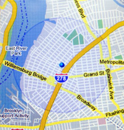
Google Maps mobile, displaying location based on cell tower usage
Keeping people informed with timely, contextually relevant emergency, transportation and other public interest information can prevent people from getting in harm’s way or to plan more accordingly to subway delays, just to list a few. Unfortunately, such information is often posted after the fact or on some obscure website that people need to check to discover if there is an issue. And major news outlets are typically not useful for the more macro information which affects people’s daily lives.
New York City has just begun testing a mobile phone SMS alert system for selected areas, called Notify NYC, similar to San Francisco’s Alert SF.
But there is one problem inherent in these types of systems. They require setting which locations of the city to receive updates about. While people generally have a consistent routine, they are always on the move, and that means these systems leave potential gaps. Undoubtedly, people are at a greater risk in unfamiliar areas in regards to evacuation routes, locations of police and fire stations and hospitals.
Communicating every update regardless of a person’s location will greatly increase communication noise and decrease the effectiveness of the system and people’s perceptions of its quality–likely causing people to disregard updates or opt out of the system all together. To augment the current implementation, location specific messages should be sent to opted in people based on the cell tower which their phone is currently connected to. Thus providing contextual alerts, without any prior configuration of location preference.